The blog has been inactive for quite a while. Did I get tired of writing? Too busy, and other things to do? Yeah, all of the usual excuses. But last summer after my latest motorcycle trip I had written up a report, so I may as well paste it in here just to get caught up a bit.
===================
Trip to Alaska trip – 2015
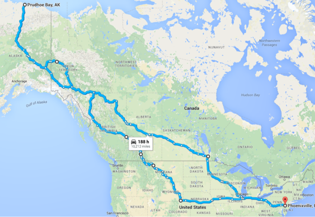
After making a cross-country trip two years ago, and finishing the list of 48 states that I’d ridden through, I decided that the next big trip would be to Alaska. And if you’re going to ride to Alaska, you may as well do it right and ride to the top, to Prudhoe Bay, the oil camp on the Arctic Ocean at the top of the Dalton Highway, the infamous Haul Road.
I began researching, reading everything I could on the Dalton, and saw a lot of scary stuff: mad truckers driving at 90mph trying to run down motorcyclists; road conditions that required the skill of the most experienced adventure rider to ride; mosquitoes the size of small birds ready to eat you alive; bears and other creatures ready to attack, and no gas or mechanical services for hundreds of miles. Only the last of these was true. Almost all of the preparation I did revolved around the few hundred miles that I would be on the Haul Road; the rest was just miles, and I know how to do miles.
Scheduling a three-week vacation is a bit tricky, as I have any number of projects going on at work. I had to reschedule a couple of times, and do a lot of arrangements to make sure that my projects would be able to do without me for three weeks. There’s also the preparation for the bike, getting new tires and maintenance before leaving, going on a couple of shorter trips to do a “dry run” on the camping gear and other stuff that I would carry with me.
Here’s what the entire trip looked like:
Day 1, 6 June 2015: Phoenixville PA to Elkhart, IN; 680 miles
Finally, after a couple years of planning, it’s time to go.
There’s not much to be excited about crossing Pennsylvania, other than knowing that this is the last scenery to be seen for a couple of thousand miles. Western PA is actually quite nice, but once you get to Ohio it just turns into interstate. Same with Indiana, and so forth. I was headed for South Bend for the for the first day’s miles, but stopped a few miles short, in Elkhart (home of the RV Hall of Fame; who knew?) because I saw a sign for a campground. I thought that being fresh I could camp for the first night.
Big mistake; the space next to mine was occupied by a couple who had a very loud argument at two in the morning, including threats of physical violence, a demand to get out, a car door slamming, and car driven off. In the morning there was stuff scattered around, the sign of personal possessions being thrown out of the cabin they were in.
Day 2: to St. Cloud, MN; 586 miles
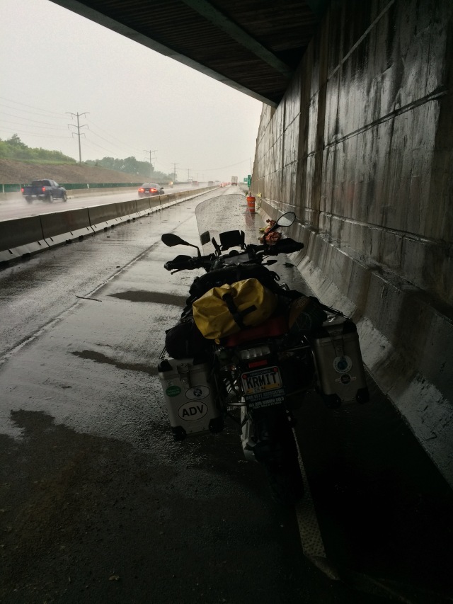
Construction south of Chicago made me miss the sign for I-80 West and I instead had to go through downtown Chicago. Fortunately it was early Sunday morning, so there was very little traffic. Just out of downtown, though, I saw dark clouds ahead of me and just barely had time to put on rain gear before the downpour hit. Then of course I had to ride through some construction; the combination of heavy rain, construction, and heavy traffic was enough that I pulled over under an overpass to wait out the storm.
I stopped for breakfast in Madison, and sent a text to my daughter Cassandra who went to law school there; she teased me about eating at Denny’s when there are so many good restaurants in town, but I had to keep moving and didn’t have time to ride all looking for the best breakfast in town.
Day 3: to Moosomin, SK; 609 miles
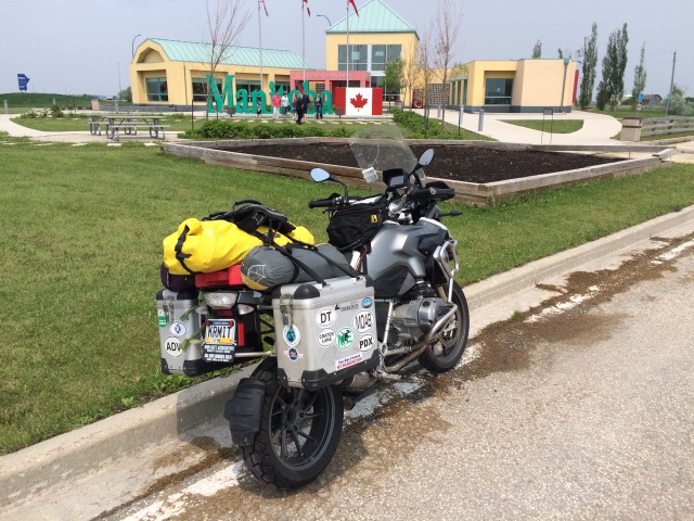
There’s nothing really to say about riding through Minnesota and North Dakota. I had to wait for an hour for the border crossing into Canada south of Winnipeg.
Day 4: to Edmonton, AB; 643 miles
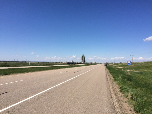
The Canadian prairie is just as boring as the US plains. I thought that I preferred the US crossing, but after my ride home across I-80 I think that I might prefer Canada; the gas and hotel prices are double, but there is nowhere near the truck traffic that you see on the US east-west routes.
I used to like staying at Super 8; they had a good balance of price and quality. But at the Super 8 in Edmonton I realized that the chain is trying to go upmarket; fancy lobby and a fancy price. I ended up getting out of town, past the construction, and going down the road twenty miles to a suburb with a more reasonably priced motel.
Day 5: to Fort Nelson, BC; 623 miles
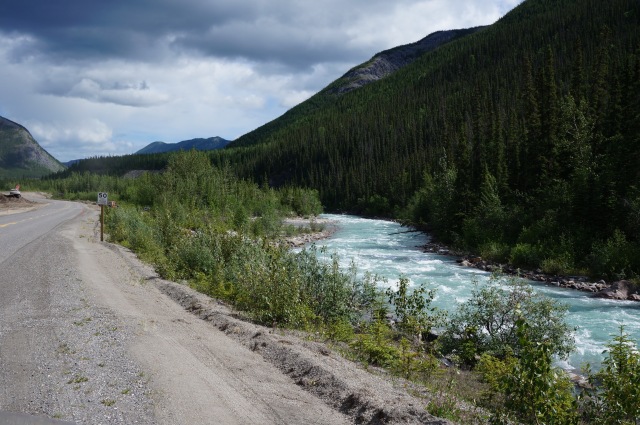
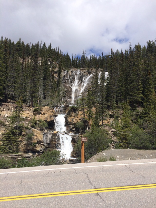
Finally… some nice riding. After paying my dues with four days of cross country riding I got off the main roads and into some interesting scenery. Not quite into the mountains until later in the day, but things were definitely improving. There was a lot of logging going on in the areas I rode through, as well as a good deal of fracking. I saw a lot of heavy equipment for both on the road, and the sorts of companies in the towns I rode through, and advertising alongside the road, attested to what drove the local economy.
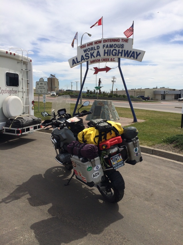
Mid day took me through Dawson Creek, which is at mile zero of the Alaska Highway. The highway is 1450 miles of road through British Columbia, Yukon Territory, and Alaska, built by the US government with permission of the Canadian government, in six months in 1942 in order to ensure a land route to supply Alaska in case of Japanese attack.
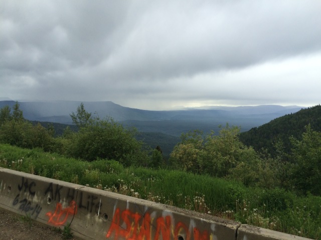
Riding the Alaska Highway through the mountainous terrain gave me a lot of appreciation for the work that the thousands of men did in a very sort amount of time to build this road. Of course there have been a lot of improvements made since then – I occasionally saw road signs for “Old Alaska Highway”, attesting to a change in route – but even building anything at all drivable, of that distance and in that short amount of time is amazing.
Day 6: to Whitehorse, YT; 591 miles
Today I ran into some rain, though not too bad, and went through some beautiful mountains.
Occasionally while riding also the Alaska Highway I would see the remains of an old gas station, long since closed. I can just imagine the number of gas stations that opened up to service the highway in the 1940s and 50s, probably every 30 or 40 miles. Many of these are now closed, and at times it’s a bit nerve racking hoping that the tank holds enough gas to get to the next opportunity to gas up.
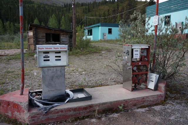
All across Canada gas was five or six dollars a gallon, and in most locations on the Alaska Highway you take what you can get as far as quality; regular unleaded is the best you can hope for, and you can’t count on getting a full service gas station with snack shop.
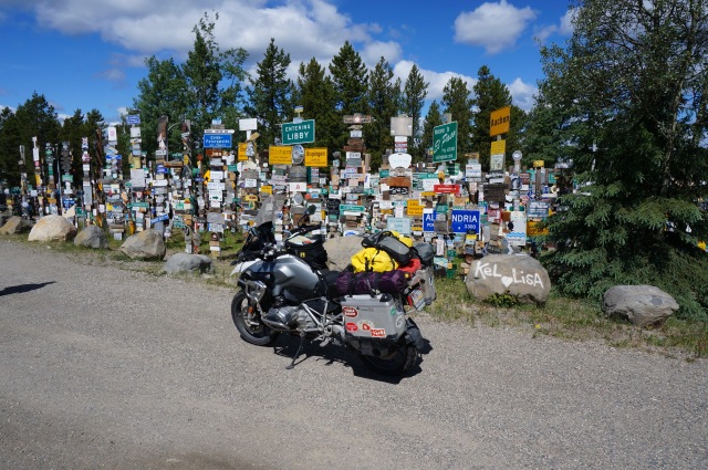
More beautiful scenery for the day. At mid day I stopped in Watson Lake, which served as a camp for workers building the Alaska Highway. Apparently, some workers posted a sign with distance and direction of their hometown, and a tradition was born. Today the town has a multi-acre park filled with signs from hometowns of people who have passed through.
Whitehorse was a very modern and fairly large town, out in the middle of nowhere. It’s a bit mind boggling to think that everything in this town was hauled in by truck over one of two highways for a few hundred miles. But that’s really the case with all towns everywhere, though some are less remote than others.
The next morning as I was packing my bike to leave I noticed a row of bikes in the parking lot, a tour group on BMW bikes, with a support van. The guys were all from Spain, apparently. I spoke with one rider, and also with the (female) tour guide/van driver. They were also going to the top at Prudhoe Bay, then would, in stages and with different groups of riders, make it all the one down to the bottom of South American. This seems to be a fairly popular ride among South Americans; I met more than one person from South America that was doing just this.
Day 7: to Dawson City, YT; 331 miles
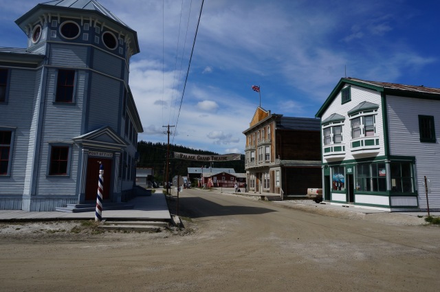
Today was a short day, as I reached Dawson City by lunchtime. Dawson City was a gold rush town, once the biggest city in all of the Yukon and Alaska, famous for its brothels and wild life. Today it’s a national monument, preserved to show the architecture of 115 years ago. The streets are dirt, the sidewalks are made of boards, any new building must fit into the architectural style, and old building no longer fit for use are left as is rather than being torn down.
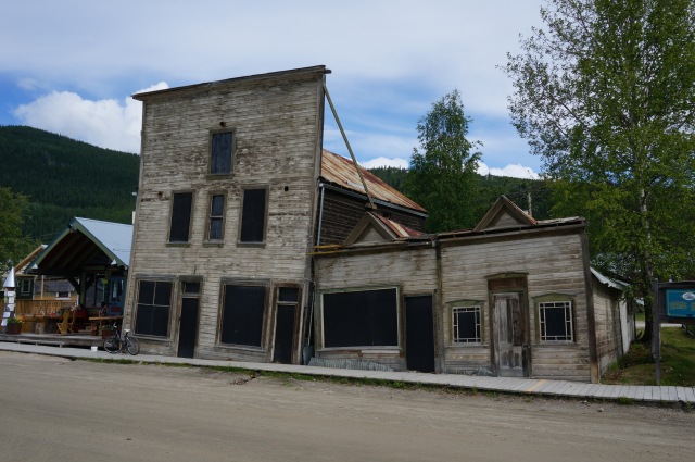
This pair of buildings show what happens when you build a heated building on top of permafrost.
After checking into a hotel I wandered around town a bit, took photos, etc. It was nice to get off the bike for a while; this was my first break since leaving home.
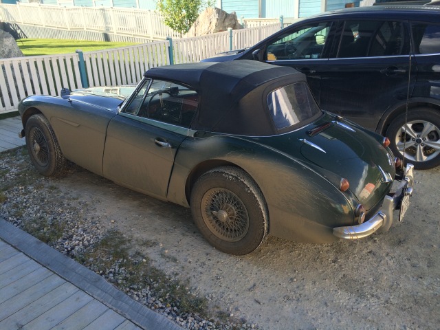
At the same hotel I noticed a number of Austin Healey 3000 cars, seven in total, from various parts of the US. I had come over some somewhat rough roads to get to Dawson City, as was surprised to see such nice cars having gone over the same roads. They were as covered in mud as my bike, and I was wondering about rock damage. I talked with one driver that afternoon, and another the next day at Chicken (they were following the same route as I), and asked about the concern for damage to such nice antique cars. “I’m not getting any younger” was his reply.
Day 8: over the Top of the World Highway, across the border back into the US, Chicken to Tok then Fairbanks, AK, then Yukon River Camp, past the Arctic Circle, then to Coldfoot on the Dalton Highway; 641 miles
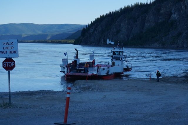
The road out of Dawson City requires a ferry trip across the Yukon River. The ferry is free of charge, and runs on demand, and I only had to wait a couple of minutes to board. It’s apparently cheaper to run the ferry than build a bridge, or maybe they just like it better that way.
The Top of the World Highway runs for 165 miles from Dawson City, across the border into the US, through Chicken, to rejoin the Alaska Highway near Tok. Most of the Highway is gravel, and I was nervous about riding this not knowing the condition of the road, but it turned out to be in very good condition, and gave me a lot of confidence for the Dalton Highway that I would be on the next day. The border crossing didn’t open until 9am, and I arrived there about quarter after, just behind the Austin Healy group – or rather in the middle of them as I had passed three of the cars. The border station is in a very remote location, and I asked the guard what they did up there. His reply was that they had all volunteered to work there, and that they hiked a lot, and sometime ran into Dawson for some dinner.
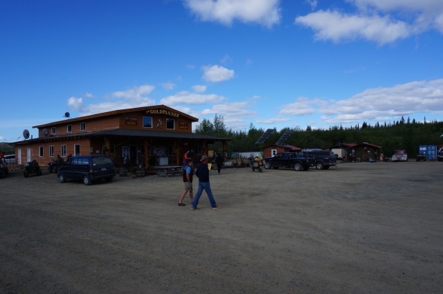
Chicken was a gas stop with gift shop selling chicken themed shirts and stickers. I had expected to see an old mining town, and it wasn’t until later that I heard that the historic part was down a side road, and I had missed it. There was supposed to be a music festival that day and the next, but I didn’t see any additional crowds for it.
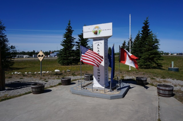
After getting back on the Alaska Highway, it was an hour to Delta Junction, the end of the Alaska Highway.
It was nice to be back in the land of more reasonably priced gasoline – only $3.50/gallon instead of the $5 or so in Canada.
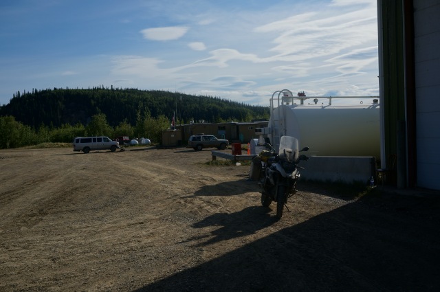
In Fairbanks I stopped for lunch and gas, and not wanting to waste another half day decided to head on up to Coldfoot.
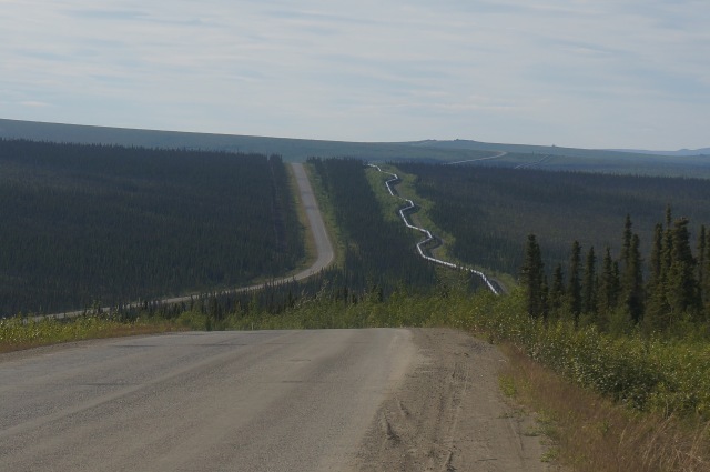
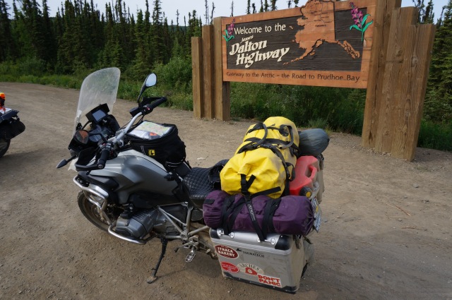
The Dalton Highway, otherwise known as the Haul Road, and famous from the Ice Road Truckers TV show, was built to service the oil fields at Prudhoe Bay on the Arctic Ocean, and runs alongside the Alaska pipeline that runs from said oil fields, north to south all the way across Alaska to the harbor in Valdez. Like the Alaska Highway, the Dalton Highway was built in a hurry, in just one summer in 1972; this one was privately built by the oil companies instead of by the government. It’s got quite the reputation, and I heard a lot of horror stories about it (extremely poor road conditions, truckers out to get you, bears out to get you, mosquitoes out to get you, etc.), none of which I found to be true. Except for the mosquitoes at Coldfoot.
I had also heard, just a week before leaving on this trip, that the Dalton was closed just a dozen or so miles from Prudhoe. It was announced that the road was open again the day that I left, but I decided to keep my options open, so cancelled my reservations for a hotel at Prudhoe Bay, and for new tires in Fairbanks, thinking that I would probably just ride to the Arctic Circle. I would decide later whether to attempt a ride to the top.
The first 80 miles north of Fairbanks was on paved highway; the Dalton starts just past Livengood.
The Highway was alternately paved and gravel, with the gravel in generally very good shape, allowing speeds of 60+ mph. In fact, my average speed on the entire Highway, 850 miles up and back, was about 55mph. For 30-40 miles north of Coldfoot there was significant washboard, and there were occasional potholes, but the road was nowhere near the horror story that I had been led to expect.
The first fuel stop is at Yukon River Camp, just on the north shore of the Yukon River. I had just crossed the river on the ferry in Dawson earlier that morning, but now I was a few hundred miles downstream. Gas here was the most expensive on the trip, at $5.50/gallon. I missed the “gas station”, not seeing the pump, but after riding a couple miles further thought that I’d better go back and look closer. (A guy I spoke with the following day had the same problem.)
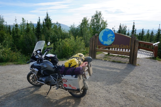
Next up was the Arctic Circle, a great photo op, but not much else. I met and chatted with a couple of guys from Brazil, who I ran into again a couple of times the next day.
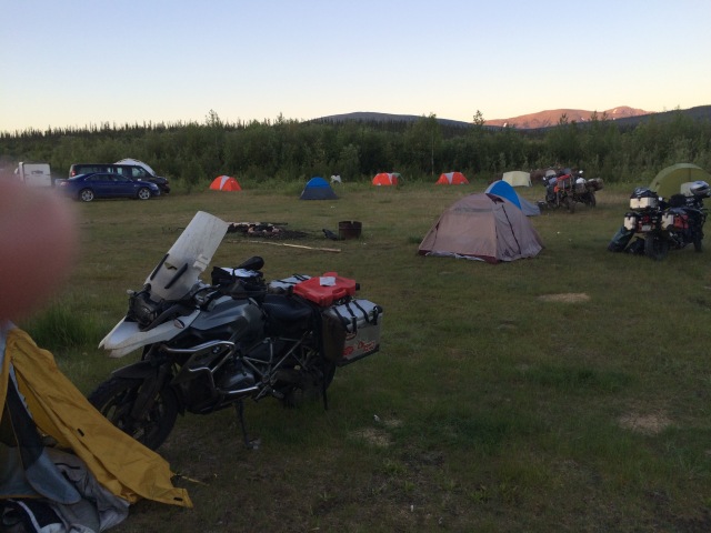
To end the day I stopped at Coldfoot Camp, where gas, food, and mosquito-infested camping was to be found. At the end of a long day, it’s such a joy to set up a tent as quickly as possible, climb inside and zip up before the critters get inside with you, then spend the rest of the night inside. Note also that in these northern latitudes it was light all night; as tired as I was it was difficult to get to sleep in the full daylight.
This photo was taken the following night, at 3:30 in the morning.
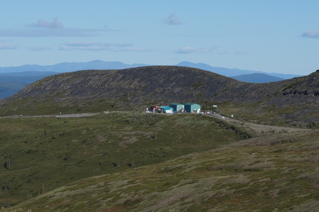
Day 9: from Coldfoot to Prudhoe Bay and back to Coldfoot; 490 miles
Coldfoot is the last gas for 250 miles until Prudhoe Bay; my bike, if I’m careful, will give me 210 miles on a tank, so I had to carry additional gas. The first half of the ride north was more of the same that I’d done yesterday, rolling hills and alternating pavement and gravel, with some pretty nice scenery.
The highway goes over the Brook Mountains at Atigun Pass, at 4700 feet. I was comfortable riding this steep, gravel road on a bike, but I feel from the truckers who do this in their big rigs, especially in bad weather or in winter.
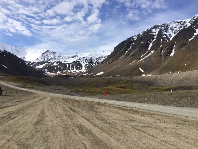
Past the pass the mountains disappear and the tundra begins. Again, the highway alternates between paved and gravel, but the road is almost perfectly flat. I saw a small herd of caribou, and a person I talked to later mentioned muskox, though I didn’t get to see those.

The road had indeed been washed out in a few places just before Prudhoe Bay, starting a dozen or so miles before the town, and the final washout a major one, just as the road enters the town. Road construction was still going on, with several crews and pilot cars, but I wasn’t delayed too long. Once I arrived in town, I found the (single) gas pump and filled up, and ate the sandwich I brought from Coldfoot.
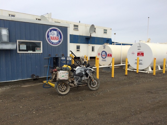
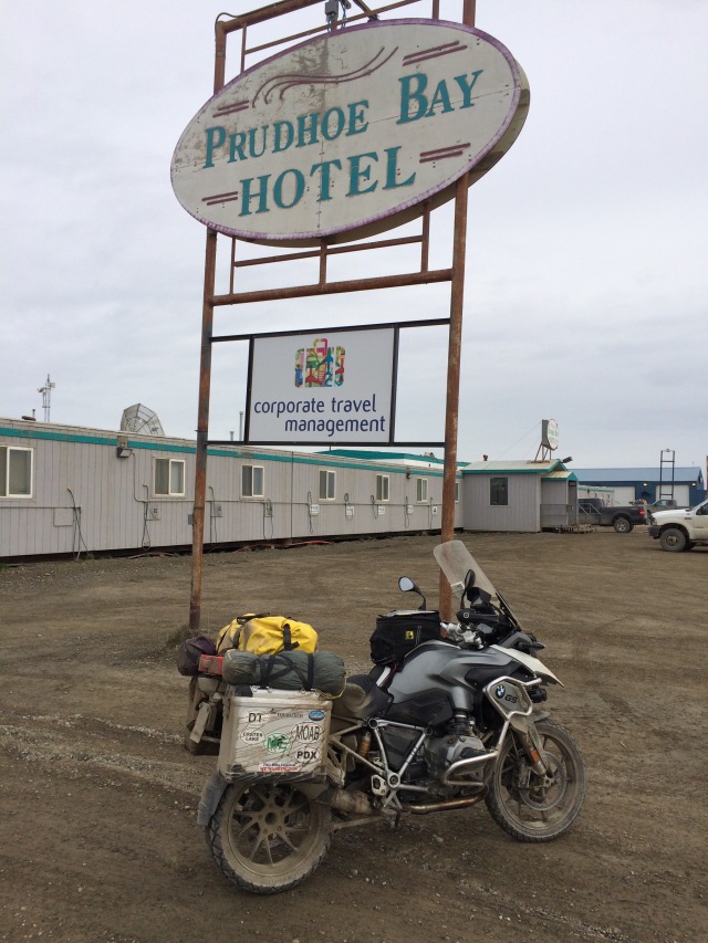
A couple of different local workers stopped to talk with me; I was probably the only thing new they has seen in a while. There are no restaurants, stores, or theatres in Prudhoe Bay; workers live in company dormitories and eat in company cafeterias; they are flown in to work shifts of several weeks, then flown out for breaks. I don’t even think that it’s a town; there are no residents and no businesses. It’s simply a bunch of oil companies working in the same location, with trucking companies there to keep them running.
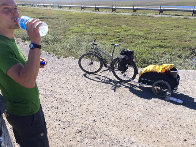
After a short break with my lunch, I headed back. The scenery going back was much better – the Brooks Range mountains from the north are spectacular. A ways down the tundra I stopped to chat with a guy on a bicycle. He was from Switzerland, and thought that it would be a grand adventure to ride a bicycle from the Arctic Ocean down the Fairbanks, about 500 miles. On the gravel roads he was making about 30-40 miles a day, and carried his own food and water in a trailer. I gave him a bottle of water and some food, and a hour later sent some more back to him when I ran into my Brazilian friends. I had been feeling proud of myself for riding from Philly to the top of Alaska, but what he was doing took guts.
Almost all of the anxiety I had gone through the last couple of years in planning this trip had been around riding the Dalton; all of the horror stories and warnings, etc. had caused a lot of concern. The rest of the trip was just miles, and I know how to do miles. But ultimately, the Dalton was a one-day, up and back ride. Not easy, but certainly doable. I was fortunate in having good weather; I can see how a bad weather day could turn this ride into a disaster. The gravel sections wouldn’t be so bad, but there were many sections of packed dirt, which is sprayed with a solution to glue the dirt together but when wet makes the road very slippery. I rode over a couple of sections that had just been sprayed and they were treacherous, to say nothing of covering the bike with gritty mud.
I arrived back in Coldfoot in the early evening, after a long day, to face the same setting-up-camp-while-avoiding-mosquitoes exercise as the night before.
Day 10: back to Fairbanks; 255 miles
My goal of reaching the top accomplished, now it was time to get home. I got back to Fairbanks by lunchtime, got lunch and gas, and found a car wash where I could spray the worst of the mud off the bike. I didn’t want to ride it like that, plus I needed to get new tires and an oil change, and no one is going to work on a bike covered with mud.
I had previously arranged for a set of new tires from an independent installer so that I could make it to Prudhoe Bay and back, but when that part of the ride was in doubt I cancelled the order. The tires I started with, nearly new when I left home, so now with only 7k miles on them, were not going to make it home. I called the BMW dealer in Fairbanks, and after a half hour on hold was finally told that they had nothing that would fit. I called the independent guy, and while he had sold the tires that I had originally reserved, he did have a set of another type that would fit. So I rode up to get them installed. While I was there I should have asked if he could do an oil change, but I forgot to ask until after I had left, so thought that I could just drop by the BMW dealer and have them do it in the morning.
Day 11: to Haines Junction, YT; 492 miles
I arrived at the BMW dealer a half hour before they opened, as I wanted to be first in line in case there were other travelers dropping in for service. Their web site gave the impression that they welcomed travelers, but in practice they seemed to treat travelers as a bit of a nuisance. Despite being there early, it took them an hour to write me up, then another hour before they brought the bike in, then an hour to do the work – a twenty minute job. It was 11:30 before I was on the road again, a half day lost.
South on the Alaska Highway, and across the border back into Canada. To make up for lost time I rode late into the evening, not arriving in Haines Junction until nearly 10 pm, at which time all the restaurants were closed. I finally found one where the cook was still available, even though the owner wasn’t happy about staying open. Then I went back to a campground I had passed on the way into town and found a spot where I could set up the tent.
Day 12: to Dease Lake, BC; 500 miles
I continued on the Alaska Highway to nearly Watson Lake, then turned south on the Cassiar Highway to go south. This highway starts just a couple of miles north of the border between Yukon and BC, and the Yukon portion was gravel; I suppose that they see no need to put money into the road that doesn’t serve any portion of the Territory. Once I crossed into BC the road was paved, though not well, but the further south I went the better the road condition. I expect that this is because there is more traffic originating from the south, so this is where the maintenance is done. The scenery along the Cassiar was quite nice, though nothing as spectacular as I had seen before.
About midday it started to rain, and by early evening when it was time to stop for the day I was counting the miles to the next town where I could stop. I was very happy to get to Dease Lake; the hotel owner was very friendly, and there were a couple of restaurants across the street, but unfortunately by the time I had showered and changed, and walked across the street it was just after 7pm, and all the restaurants were closed. Fortunately the grocery store was still open, so I put together what dinner I could from what I could find on the shelves.
Day 13: to Prince George, BC; 602 miles
Rain, rain, rain all day. Dease Lake was only halfway down the Cassiar, and a long stretch had no gas stations. I made it to the single station along a couple hundred mile stretch and then again to the next one at the junction of Highway 16 ay Kitwanga. I thought that this being a major road (or at least that’s what the number would suggest) I would get on a bigger road, but it was more of the same though more heavily trafficked.
With continued heavy rain, I was pretty happy to get to Prince George. I was a bit disappointed with the town once I got there; what looked like a major city had a downtown that was all boarded up. The motel that I stayed at was just a couple blocks from Main Street, but I had to walk for a while, in a drizzle, to find a restaurant that was open.
Day 14: to Jasper, through Jasper, Banff, and Kootenay Parks, to Wasa Lake, BC; 523 miles
More rain, at least for the morning. By the time I got to Jasper at lunchtime the rain had stopped, and the rest of the day was just scattered clouds; I was so happy to be able to take off some layers after 48 hours of rain. (Hint for the next ride: get better rain gear.)
Jasper itself is a touristy ski resort town in the middle of a national park, full of boutiques and shops and restaurants. For those of you from Utah, think Park City, but with hundreds of big RVs parked everywhere. I stopped for lunch and gas then headed south.
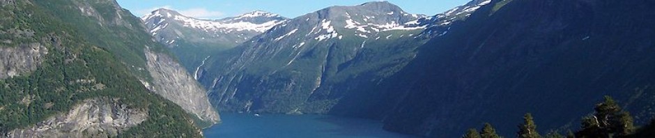
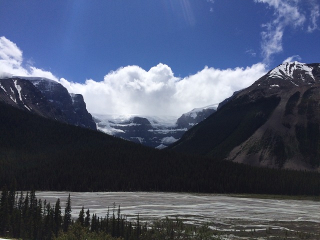
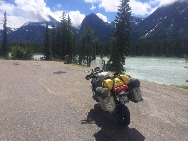
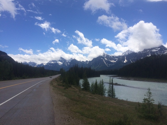
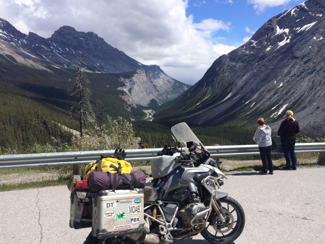
I was expecting some scenery, this being a set of national parks (Japser, Banff, and Kootenay), but I hadn’t expected this. Gorgeous! I was blown away by the beauty of this place. Starting a dozen miles south of Japser city, the mountains, lakes, and streams are magnificent. For about 50 miles or so around every turn was a scene worth pulling over to take a picture of. And everyone did. I got used to cars suddenly darting to the side to stop, and I did a fair share of this myself.
Finally after a couple hours of sensory overload the scenery calmed down a bit, though stayed pretty for the rest of the day. I had intended to cross the border and get back into the US by end of day, but just couldn’t get that far. By evening I made it to Wasa Lake, and provincial park with a campground, so decided to stay there, and had one of the most pleasant evenings I’ve ever had camping. Maybe it was the lack of rain, and mosquitoes, and noise, but the campground was simply pleasant. I had a quiet site to myself, a picnic table to sit at to eat the last of what I was carrying with me, and I didn’t have to rush to set up the tent and crawl inside to escape rain and bugs.
Day 15: to Bozeman, MT; 473 miles
I crossed the border back into the US the next morning, then for the next couple of hours rode through some scenic Montana landscape through Kalispell and to Missoula. Flathead Lake seemed to go on and on, and though traffic backed up a bit, the ride was rather nice – the last I could say this. Once I hit Missoula it would be freeway the rest of the way home.
Day 16: to Sidney, NE; 697 miles
Day 17: to Iowa City, IA; 644 miles
A pair of rather unpleasant days. Once on the freeway it encountered my other weather nemesis: the wind. Across Montana and Wyoming the wind was strong, and changed from head wind to side wind according to the direction of the road and the whims of Aeolus. Traffic wasn’t terrible, but occasionally the trucks got a bit thick, and road construction every few miles made riding a consistent speed difficult.
Across Montana, Wyoming, and Nebraska I was struck by the lack of any windmills to take advantage of the strong, consistent winds. How we could we let all of this free energy go to waste? I expect that these states don’t have much need for power, being sparsely populated, but electricity is pretty easily transported elsewhere. I didn’t see any windmills until Iowa, and by the winds had died down significantly.
Iowa was also getting pretty hot. While for most of the trip the temperature had topped out in the mid 80s, I was now in the low 90s and feeling pretty drained. At one rest stop I had to lay down on the grass and tried to rest, but was unsuccessful.
At the beginning of the second to last day I calculated the distance to home, about 1600 miles, and planned to do it in two days of 800 miles each. This was a bit aggressive but doable. I stopped in Iowa City for dinner, and planned to ride for another couple of hours, but saw on the weather may a major storm ahead of me and another approaching behind me, and decided it would be best to call it a day.
Day 18: back home; 950 miles
I had a very unpleasant morning riding past Chicago; the trucks on I-80 are unbearably thick. I knew this already, and had previously considered going south to I-70 (which would also allow me to skip some highway tolls), but that would have taken longer and I wanted to get home.
I started the day intended to make it to Pennsylvania, stop for the night near Pittsburgh, then make it home by noon the following day. But when I got to the PA border I felt good, and thought that it would be silly to stop because by the time I got a hotel, showered and ate I could be almost home. So I kept going. I don’t like riding at night – my eyes aren’t what they used to be – but the traffic wasn’t bad and I knew the road fairly well. There was a bit of threat of bad weather, with the radar map showing a storm ahead, but I was fortunate in not running into it.
I finally got home at 11:30pm, after a 16 hour day, with the total trip being about 10,300 miles.
Lessons learned
If/when I do another long trip like this (and I would love to go back to Alaska to explore more roads), here’s some things that I should do:
- Ship the bike. I had debated whether to ship the bike to the west coast or not. I’ve now ridden across the Midwest a few times; I don’t need to do it again. Shipping the bike and gear costs money, and ties up the bike for quite a while (they usually wanted 4-6 weeks each direction), but the downside of riding is the daily expense of being on the road (with gas, food, and hotel, about $200-250/day), plus tires, but especially the time – I spent about eight days of my vacation not really having much fun, just putting in miles in uncomfortable conditions. It was only once I reached the Rockies, and until I reached the plains again, that I was really enjoying myself.
- Get better rain gear. It’s no fun riding in the rain, and it’s worse if you are cold and wet yourself.
- Make sure that you have tires waiting for you in Fairbanks. Don’t count on there being a set available. I was very fortunate that it worked out the way it did, but it very easily could have been a bad situation, as the next closest BMW dealer was in Calgary, 2000 miles further.
- Don’t be stuck to a tight schedule. I had planned the first few days to be high miles, and was stressed on the second and third days because I had lost some time because of weather. Because of the need to make reservations for hotel and tires for the Dalton Highway I had to stick with the schedule I put together, but in the end cancelled it all and just rode day to day. This gave me the flexibility to ride longer or shorter days depending on how I felt, weather, and stopping to admire scenery.
- Stop and admire the scenery more. I’ll probably never get back to some of the places that I saw, and while I took pictures, I never stopped and just sat to admire what I saw. A more relaxed schedule would have helped, but I had an objective to get to the top and back, and only had so many days of vacation time (and money) to do it with. So a less aggressive schedule would have helped.
Addendum (response to questions):
I didn’t really carry much food. Snacks, mostly, but enough to serve as a meal in a pinch. I didn’t carry any cooking equipment, but the tent, bag, and pad allowed me to camp five nights out of 17 on the trip. I was trying to save a little bit of money, plus be prepared for unforeseen “stuck in the middle of nowhere” scenarios. But I really prefer a hotel with bed and shower at the end of a long day.
I had originally planned out the trip in detail, including a reservation for a night in Deadhorse and bus tour to the Arctic Ocean the next morning, but with the uncertainty of the Haul Road being open I decided to cancel those reservations and just wing it. I still ended up being close to my original schedule, but as I mentioned in my writeup, it turned out to be a lot less stressful not having to follow a tightly planned schedule.
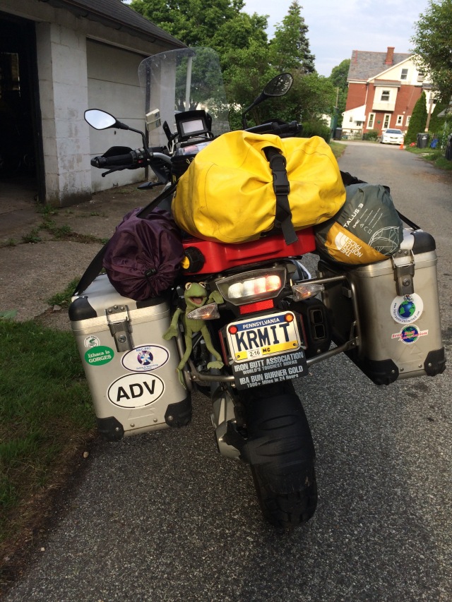
While others may disagree, and I’ve only done it once, I think that the R12GS was the perfect bike for this trip. I’ve heard others say that a smaller bike is better for the Haul Road itself, but I wouldn’t know. Unless you’re starting from the west coast, or are trailering bikes across the midwest, you need a bike capable of getting you across the country in decent time, big enough to haul gear, as well as able to handle bad road conditions. The 500 miles from Fairbanks to the top (and then 500 back) are probably two thirds or more paved, and the gravel and packed-dirt sections are in generally pretty good shape (after all, they’re running big trucks on these roads, and trucks don’t like potholes any more than we do), but this isn’t a road for a full dresser or cruiser — there’s lots of gravel, and if there’s rain there would be a lot of mud. An RT or LT would probably work, with 50/50 tires, but I think that the suspension on the GS is much better suited. I was very fortunate in having good weather; the only mud I encountered was from highway workers spraying the road.
Thankfully I had no breakdowns. My GS is a 2013 and have 22k when I left, so in great shape. I wouldn’t make this trip on a bike with issues. As all of the books and articles that I read remind you, north of Fairbanks there’s very few services, and north of Coldfoot there’s no gas for 250 miles. If you break down, a tow could be *very* expensive. I wouldn’t fear for my life — there’s a fair amount of traffic on the road, and I don’t doubt that you could get a ride, but you may end up having to leave your bike there.
The BMW dealer I went to in Fairbanks was Trail’s End (http://www.outpostalaska.com/). As I said in my report, while their web page implies that they welcome and go out of their way to help travelers, my impression was that they think those of us who can’t make a reservation several days in advance are a nuisance.
The independent guy was Dan Armstrong (http://www.advcycleworks.com/) who I highly recommend. I had ordered tires from him in advance, but then because of the uncertainty of the Haul Road closure I cancelled. He gave me a refund, no questions asked. Then when I got there, and called to see if he might still have some tires that would fit he was happy to help me. He did the work right away, and charged a fair rate. It was very fortunate that he had a pair that fit, as getting tires shipped to Alaska takes a while, so advice I give you is to get these ordered.